CITY HALL — City officials acknowledged at last week's Planning Commission meeting that they incorporated a previously unaccounted for map into an important planning document, changing the designation of some lots from residential to commercial.
That map, the city attorney said, was included in the planning documents viewed by City Council before approval. Previously, there had been confusion about its origins.
Northeast Neighbors, a neighborhood group, noticed the map when a developer proposed a five-story building for one of the so-called "A lots" on Wilshire Boulevard at Berkeley Street.
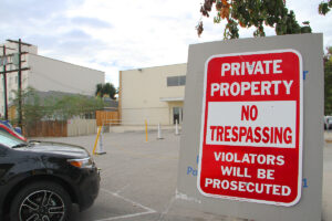
The "A lots" are used for parking but historically they retain underlying residential zoning. In the Land Use Circulation Element (LUCE), a map depicts many of these lots as zoned for commercial uses. The LUCE was created in 2010 to guide development for years to come.
Councilmember Kevin McKeown said in a November letter to the neighborhood group that no one could recall discussing or voting on the map during the LUCE debate.
Northeast Neighbors filed a public records request with City Hall attempting to find the origins of the map but got no answers.
"It was not clear to staff as to what led to the map being inserted," City Manager Rod Gould told the Daily Press at the time. "And why and whether or not there was adequate documentation of that change, much less public consideration, is very much in question."
Last Wednesday, however, City Attorney Barry Rosenbaum told the commission it had been there all along.
"It was in the documents that were recommended to City Council by the Planning Commission," he said.
At the meeting, city officials recommended that most of the 89 lots be returned to their pre-2010 residential status. Commissioners concurred with the recommendation but still had questions.
"These changes were made and put into the LUCE consciously. Why did that happen?" asked Commissioner Richard McKinnon. "Here we are. The LUCE was adopted in 2010 and we're being asked tonight to change back. Why were the changes made in the first place? I've never understood that."
Planning Director David Martin had several explanations.
"I think generally the changes were made in some cases to accommodate the activity centers," he said, "because in order for the activity centers to exist where they're specified, you would need to change the underlying designation to reflect what would be allowed in the activity center, which was a mixed-use type of development."
In other cases, he said, there were existing commercial buildings on the lots so city officials wanted make the zoning rules conform to the current uses.
"Some of the times, staff looked at the development, or some of the sights, along Pico and other places, and saw that because of the shallow lot depth, it would be difficult for there to be a mixed-use project or something to be developed on that site because it's not as deep as what would be needed to accommodate underground parking and a real mixed-use project," Martin said. "Going along with the thought that the LUCE encouraged development along the boulevards, in an attempt to preserve the residential neighborhoods, some of the parcels along the boulevard were expanded in terms of the commercial designation in order to allow or to, you could say, incentivize the redevelopment of those properties."
They weren't made without thought, he said, but they were not thoroughly discussed by the public so the Planning Department opted to bring the lots back for discussion.
"We got questions from the community and council members and others saying, ‘Where and when was this discussed during the LUCE process?' And we weren't able to identify certain places, either in staff reports or representations, where those changes were thoroughly discussed," Martin said.
McKeown's top priority, he said, is to see the changes through.
"Northeast Neighbors, joined by other neighborhood groups, helped get the right outcome," McKeown told the Daily Press. "The ‘A lot' map changes had never been fully discussed, and reverting those properties to the historic residential land use designation was the right thing to do."
Representatives from Northeast Neighbors agreed but argued that City Hall's communication on the issue was flawed.
"Tonight we've heard multiple explanations that we've always suspected: That staff saw that because of the shallow lots it needed to deepen the land along the boulevards to accommodate mixed-use," Northeast Neighbors Vice Chair Tricia Crane told the commission during the public comment portion of the meeting. "We've heard tonight that changes were made to accommodate activity centers. Never before has this been stated in public. I feel that it's a bit of a whitewash. What we're engaging in tonight, as much as we want these changes, I'm stunned."
The Planning Commission is in the midst of crafting a new Zoning Ordinance, which will dictate land use throughout the city. The commission's recommendations to revert most of the "A lots" - including the property at Wilshire and Berkeley - back to their original residential designation will go to council as a recommendation along with the rest of the proposed Zoning Ordinance. Council will likely consider the Zoning Ordinance for approval later this year.
"It's not unusual that after you adopt a land use element and go back and do the zoning ordinance that there are changes that come about in that process," Martin told the commission. "I think that's where we are."
dave@www.smdp.com


